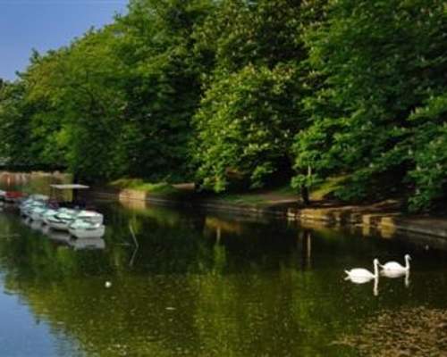
Churchtown and Botanic Gardens Walk
About 2 miles north of Southport, is the historic and carefully preserved village of Churchtown, which is listed in the Domesday Book and which dates back to early Anglo-Saxon times. We start our walk by the village green near St Cuthbert’s church and the Hesketh Arms public house and restaurant. By the old grammar school, now the local Conservative club, are the village stocks, erected in 1741 and last used in 1860, when one John Rimmer was placed in them for drunkenness. The Hesketh Arms was formerly called the Black Bull and the landlord was William Sutton, founder of ‘South…
Learn More
Coast to Countryside Walking Route
We start at Hall Road Coastguard Station, where with adequate precautions a vehicle can be left in the promenade car park for collection later. Turning left into Hall Road we pass the entrance to the West Lancashire Golf Club just before the level crossing at Hall Road station and continue straight on down Dibb Lane, where Hall Road turns right at 90 degrees. Dibb Lane is an ancient green trackway and takes us over open fields towards the village of Little Crosby in the distance, with Linnets, Skylarks and Curlews for company. At St Mary’s Church we turn right into Back Lane and continue…
Learn More
Cheshire Lines Path
The Trans Pennine Trail (TPT) is a 346 km (216 mile) multi-user route from Liverpool to Hull, with extensions to Southport on the Irish Sea coast and to Hornsea on the shores of the North Sea. The starting point is adjacent to the TPT Seamark on Southport’s Promenade and for most of the next 23.2 km (14.5 miles), the route follows the trackbed of the former Cheshire Lines Railway. The old station frontage, complete with clock tower, still survives as the front entrance of Morrisons supermarket. Elegant Lord Street, with its Victorian ironwork, restored parks and gardens and hundreds of…
Learn More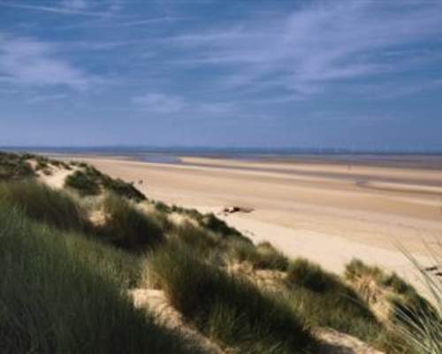
Formby Walks
ROUTE ONE This circular walk of 6.8 km (4.25 miles) starts at and returns to Freshfield Station, on the Merseyrail Liverpool to Southport Northern line. The route from the station to Southport Road passing through the Green Lane Conservation Area is on hard surfaced footpaths and roadways, whereas the other footpaths, bridleways and byways can get very muddy after rain . From Freshfield Station, cross Victoria Road into Freshfield Road and then turn left into Grange Lane. The distinctive buildings on the right are Tower House and Tower Grange, claimed to incorporate part of a 13th century…
Learn More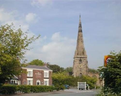
Sefton Village and the Meadows Walk
The circular walk of some four km (2.5 miles) starts at the Punch Bowl Inn, with its excellent food, drink and toilet facilities at the very centre of historic Sefton village, and is generally level throughout. Like Maghull on the other side of the River Alt, Sefton’s name reflects its geographical location and in Old Norse means the ‘hamlet where the rushes/reeds grow’. Sefton was well established before registration in the Domesday Book, when it was listed as ‘Sextone’. The Molyneux family held the manor of Sefton from the 12th century right up to 1972, when the…
Learn More
The Lydiate Loop
The walk starts and finishes at the Running Horses pub (OS Ref: 336403) adjacent to the Leeds–Liverpool Canal at Sumners Turn Bridge on Bell’s Lane. Patrons may leave their vehicles here or at the site of the former Lydiate Station (OS Ref: 335404). The Lydiate Loop Walk is approximately 9.6 km (6 miles) long and is generally level throughout. Turn left out of the pub car park and follow the footpath signed Green Lane around the field edge, crossing Maghull Brook at the footbridge and continue straight on to Green Lane. Turning right, follow the track signed Cheshire Lines…
Learn More
The Maghull Trail
Maghull is another local town that dates back to the Domesday book, where it is listed as ‘Magele’. The walking route is fairly level and at just under 6.4 km (4 miles) makes a pleasant halfday stroll and passes several sites of local history interest, including the churchyard where Maghull’s most famous former resident, Frank Hornby is buried. From Maghull Station (OS Ref: 33840) turn right along Station Road and then turn left after 200 metres on to Rutherford Road, to gain access to the Leeds–Liverpool Canal at Drapers Bridge. We then turn left (south) along the…
Learn More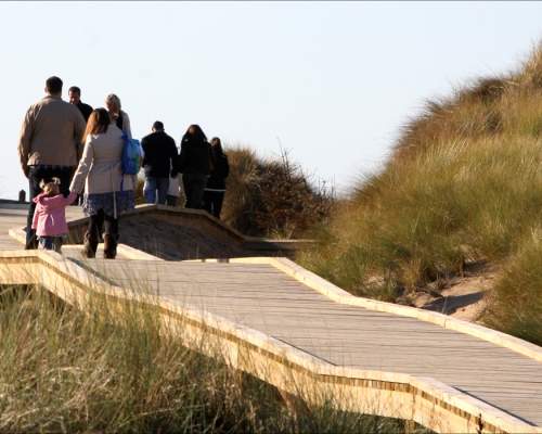
The Sefton Coastal Path
The Sefton Coastal Path is a stimulating journey through a wonderful variety of landscapes with a rich biodiversity of wildlife and a fascinating history. Sandy beaches, coastal marshes, pine woodlands, heathery heathland and tidal estuaries with invigorating vistas across the Irish Sea to North Wales, Snowdonia and even the Lake District on a clear day. The Sefton Coastal Path can be walked throughout and parts are cycle-friendly. It can easily be completed over a weekend based in Southport, or it can be broken up into individual short walks as desired. The suggested stages are summarised…
Learn More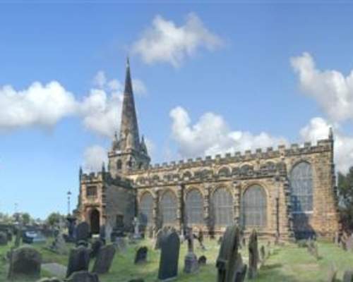
Thornton & Little Crosby Walk
Starting at the old stocks and sundial in Thornton village centre (OS ref: 333696), carefully cross Lydiate Lane towards the Nags Head pub. After 200 metres at the Gamekeeper’s Cottage turn right onto a cobbled track between hedges, which shortly turns left to cross the edge of a field leading to Back Lane. Turn left and after 50 metres the ‘Brooms Cross’ is reached. This is another of the medieval wayside crosses on the ancient ‘corpseway’ from Hightown to Sefton Church, where traditionally bodies washed up on the coast were given a Christian burial. Continuing…
Learn More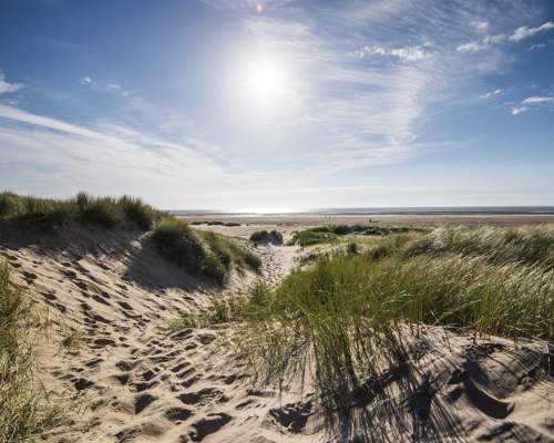
Ainsdale and Birkdale Sandhills Nature Reserve
The Ainsdale & Birkdale Sandhills Nature Reserve includes the stunning Ainsdale Hills, Birkdale Hills, Frontals, Sands Lake, Velvet Trail and Birkdale Beach and is home to rare dunes, beach and woodland habitats. There are marked footpaths to follow, and so tranquil and wild is the place that you will forget within minutes that you are surrounded by one of the most urban areas in England. This local Nature Reserve is one of the largest areas of wild dunes left in Britain and is home to a vast diversity of rare, special and beautiful species that you might not have noticed. There is…
Learn More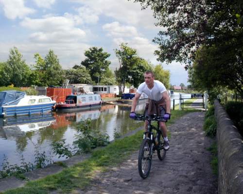
Maghull to Aintree Leeds-Liverpool Canal Walk or Cycle
This pleasant canal-side walk or cycle ride of some 5.8 km (3.6 miles) is entirely level throughout on the well-surfaced and maintained towpath of the Leeds–Liverpool Canal. From the green suburbs of Maghull, we travel southeast through farmland and open countryside, under two motorways before our route loops back northwest, alongside one of the world’s best known racecourses. Parking is widely available in Maghull and starting from Maghull Station if you wish, will shorten the walk. We start at Green Lane (OS: 373025) to follow the towpath southwards, first under the concrete…
Learn More
Meanders Around Melling
‘Melinge’, as it is listed in the Domesday Book, once overlooked the marshes, woodlands and reed beds of the River Alt. At the time of the Domesday census, Godiva the widow of Leofric, was the lady of the manor and a forest stretched from Waddicar to Wood End in Maghull. Start by turning left out of the car park at Maghull Station, across the level crossing and walk 450 metres along Melling Lane to the M58 overbridge, where we turn left on a signposted path through amenity woodland, with the green fence of the motorway embankment on the right and playing fields to the left…
Learn More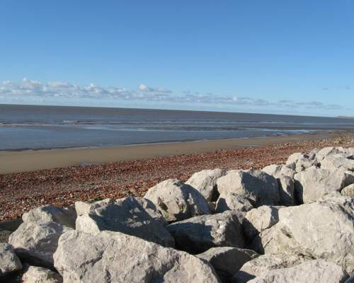
Netherton to Crosby Marine Park
This new combined cycling and walking route starts at the Aldrins Lane swing bridge on the Leeds–Liverpool Canal and proceeds westwards along the canal towpath to link up with the tarmac pathway through Rimrose Valley Park. The route then crosses the Liverpool–Southport railway between Seaforth and Waterloo stations to finish on the banks of the Mersey at Crosby swimming pool. We start at the Aldrins Lane swing bridge to follow the towpath for the next two km (1.25 miles) through the suburban housing estates of Netherton and Buckley Hill. The place name Netherton, comes from the…
Learn More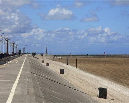
Southport Seaside Stroll
Southport is a seaside town of sophisticated charm and character, yet with plenty of activities and events on offer, right throughout the year. This short walk (2 miles) takes in some of the main landmarks and attractions and starts and finishes at the Tourist Information Centre at the Lord Street/Eastbank Street junction, near the Library and Town Hall. Crossing the road, we walk northwards on the left side of Lord Street under the ironwork canopies. Our first stop is Wayfarers Arcade, a beautifully restored shopping arcade, full of specialist shops, cafes and a Grade-II listed building…
Learn More